8 sources checked · source map still forming · 2h ago
Needs Review
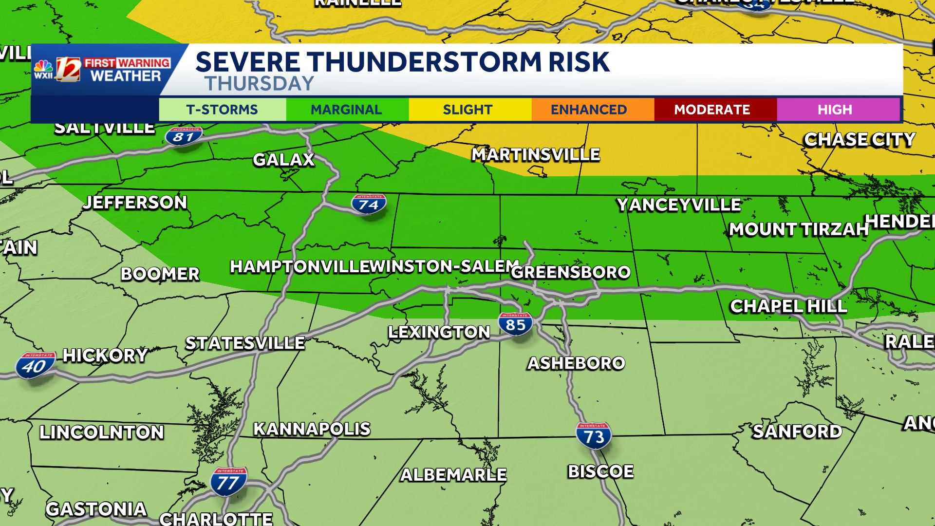
IMPACT DAYS THRU FRIDAY for the risk of severe storms | North Carolina will be hot and humid
Severe storm risks thru Friday and North Carolina heat index will soar
0 Left8 Center0 Right
Needs review.This source map is too narrow, too early, or mixed-format to trust yet.
NEEDS REVIEW
As of June 11, 2026 at 4:02 AM, this is how Optics News reads the wording differences in this story.
What happenedSevere storm risks thru Friday and North Carolina heat index will soar.
The headline splitOne side frames it as "IMPACT DAYS THRU FRIDAY for the risk of severe storms | North Carolina will be hot and hu...". The other frames it as "Impact Weather: Scattered storms Thursday, Friday across Mass. with rain, gusty winds".
Match confidenceDeveloping. Only 8 sources are matched, and the source map is still narrow. Useful to watch, not enough to draw conclusions yet.
Same-event confidenceDeveloping
Not enough sources yet to confirm this is the same specific event.
Framing confidenceHidden
Wording-gap score not shown — same-event match is still developing.
Wording differs, but the match is too narrow to read confidently yet.
WHAT EACH SIDE EMPHASIZED
Left / center-leftNo matching source in this bucket yet.
Optics keeps watching for pickup.
CenterIMPACT DAYS THRU FRIDAY for the risk of severe storms | North Carolina will be hot and humid
WXII12 (Hearst, Greensboro) · Center · News report
Right / center-rightNo matching source in this bucket yet.
Heat Advisory Thursday & Friday. Feel-like temps 95-100 degrees. Watch for late day T-storms!
Heat Advisories are already up for Thursday and Friday! I expect lower air quality conditions as well! Temperatures will climb well into the 80s and even 90s, with scattered afternoon/eveni...
Weather Impact Alert: Dangerously hot in Charlotte Thursday & Friday, Brad Panovich warns
The first extreme heat of the year will bake the Carolinas on Thursday and Friday, with temperatures in the mid-to-upper 90s and a heat index well over 100.